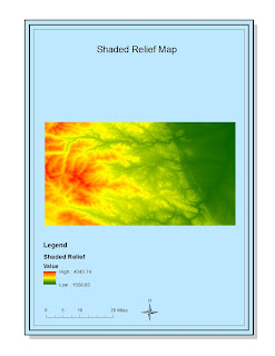
Digital Elevation Models
Making digital elevation maps (DEM'S) in ArcGIS is a great way to broaden your outlook on the potential this software has at visually displaying information. My favorite DEM's are the shaded relief and the 3D maps. They are aesthetically pleasing and present easy to understand information about the elevation distribution of this area. The use of ArcGIS to create these varied DEM's was easy, while the creation of the original map proved to be the hardest step. Additionally, the software allows for the user great potential in making creatively informative maps. I experienced no pitfalls in using the software, however there is the potential for picking color scale and gradients for the map data that don't represent it in a "user-friendly" way. Examples include visual conventions, such as blue for water, that are easily understood. Overall, working with various digital elevation maps provided a good understanding of the different ways elevation can be observed and understood.


No comments:
Post a Comment